“That’s rank, fam”, says Kid A to Kid B, casting a look of revulsion at the shopping trolley loaded high with cellophane-wrapped joints of some-meat-or-other that is blocking the pavement outside one of the halal butchers on Turnpike Lane. He’s not wrong, fam, and he could say the same about the chicken bones and pigeon shit that adorn this drab stretch of the street, with its mud brown and mouse grey houses along its northern flank and downtrodden shops on its southern. The much-hyped north London of the ‘metropolitan elite’ this is not.
It’s an unseasonably gorgeous Friday in April, not a shower in sight, perfect for exploring my own neck o’ woods. Starting out along the ungentrifiable Turnpike Lane, I’ll descend the rungs of the ‘Harringay Ladder’ to the green oasis of the Railway Fields Nature Reserve. I’ll then double-back north up the Turkish enclave of Green Lanes to Turnpike Lane tube station, before heading home-bound to Hornsey, finishing at St Mary’s Church.
Hanging a right – that is south – from that grimy starting point on Turnpike Lane, I turn into Harringay Passage, which local lore (if not established fact) says is the longest alleyway in London. At a mile in length, it’s long enough that I don’t need to leave the N8 postcode to traverse roads named after such far flung locations as Sydney, Lausanne and the Falklands; apt given that another street takes its name from that Elizabethan explorer-extraordinaire, Sir Walter Raleigh.
Remarkable for its length, true, but the ‘Passage’ is sufficiently narrow that in many places I can stretch my arms wide to touch the rough brick of both walls with the tips of my index fingers. Predating the uniform late-Victorian terraces that make up the rungs of the Ladder (and if you’re wondering why it’s known as such, just take a look at a map), the Passage wasn’t built as a convenient shortcut but primarily to provide essential access to the old sewer that runs underneath it. Clues to this can be seen underfoot, with a number of manhole covers, and towering overhead in the form of iron stinkpipes.
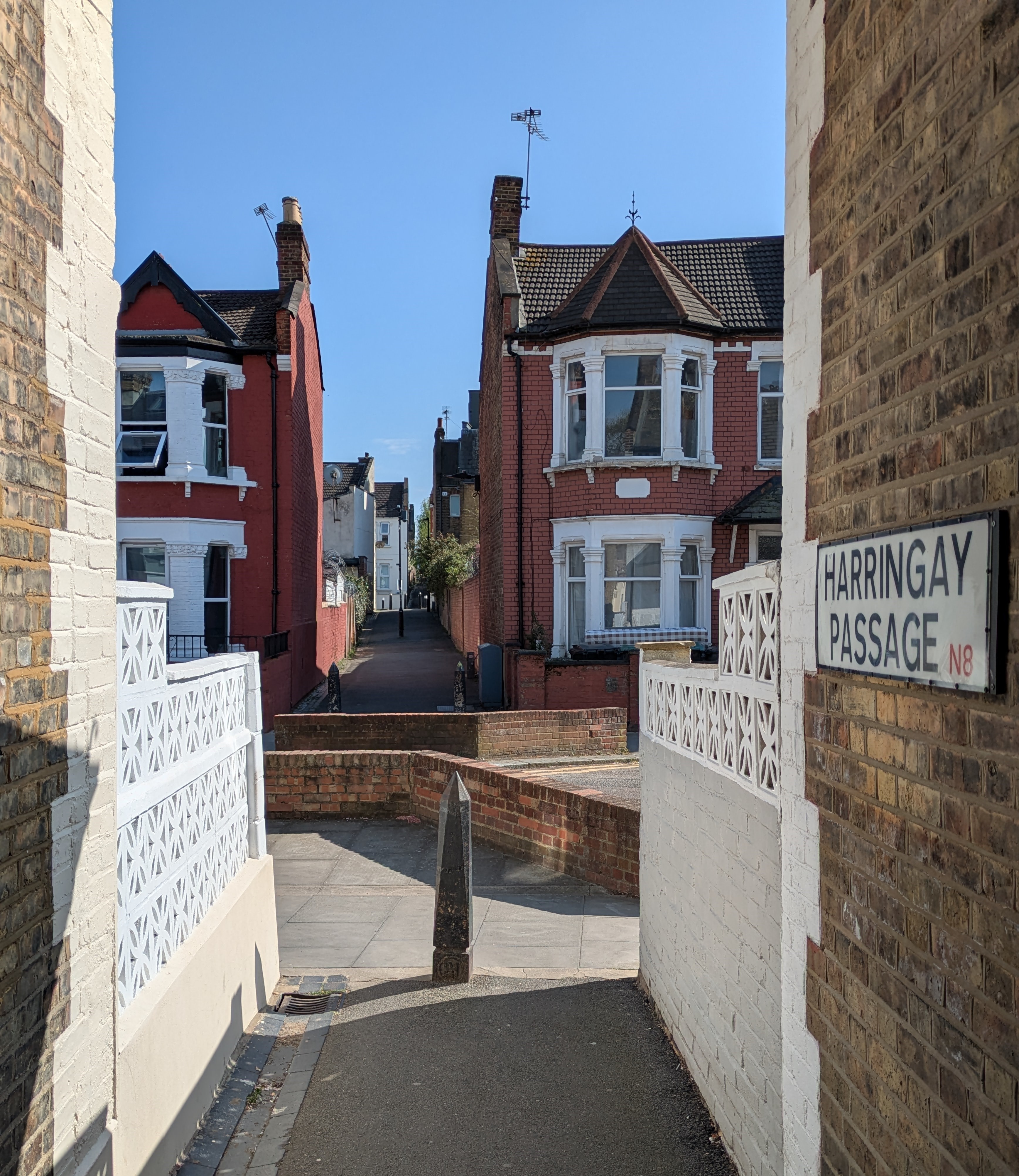
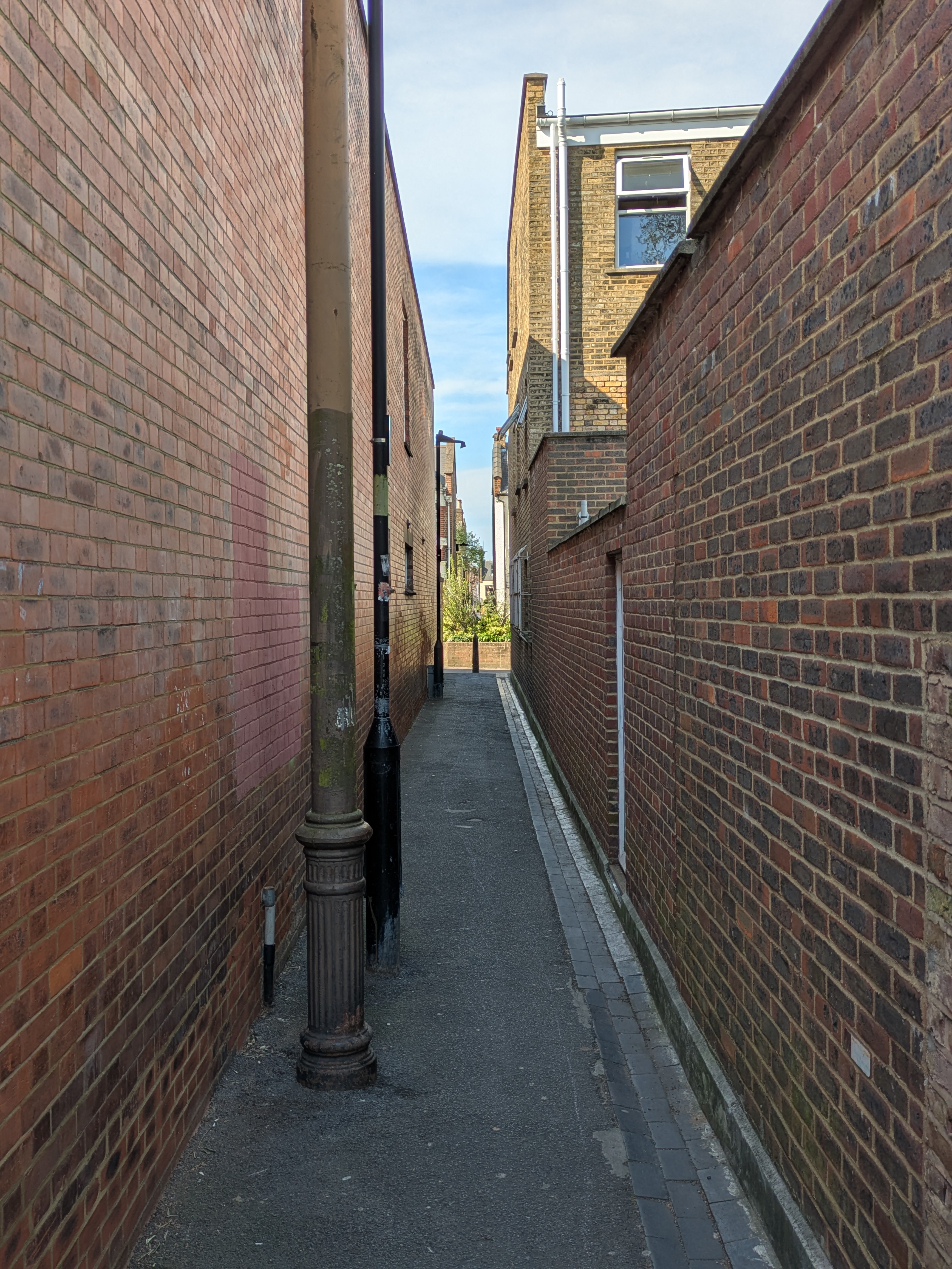
Today, the reddy-brown brickwork offsets a pastel blue sky. Such a narrow alleyway provides shade from the afternoon sun, but not shelter from the breeze, which needs no excuse to whip through this Victorian wind tunnel. Often when using this route, I find I have the entire stretch to myself, spookily quiet in contrast to the one-way rat-runs that cross west-to-east and back again, but this afternoon Harringay Passage is full of life, with mums and their pushchairs, dogs and their walkers, and a trickle-turned-flood of babbling kids spilling out of school.
The first hints of the nearby Turkish ex-pat population appear with signs asking people to clear up their dog’s mess in both English and Turkish, that tongue-twisting language that I’d recently become familiar with. The signs must be working, as I don’t notice any mess, and so too must be those guarding against other forms of antisocial behaviour that occasionally mark the route, as there isn’t a great deal of litter nor graffiti, barring the odd talentless tag. A 4-bed terrace on the Ladder can easily fetch north of a million these days, but despite the easy access to unwanted intruders that the Passage offers, there aren’t excessive levels of security on display, except for one wall topped with lethal razor wire and another with threatening shards of broken green bottles protruding from a bed of cement.
It may be the sunny spring weather, but the air is convivial, with a couple of passers-by even enacting that most un-London of motions in nodding a “hello”. Neighbours stand in doorways chatting with each other. Birds are tweeting.
Arriving on Umfreville Road, the 19th and most southerly rung of the Ladder, I take my left (your east) toward Green Lanes. Umfreville is a strange name, provoking some internet sleuthing which tells me that it, along with the nearby Endymion, Tancred and Venetia roads, is a reference to the literary work of former Prime Minister Benjamin Disraeli, who died around the time that building work on the Harringay Ladder began. This may be why the Beaconsfield pub sits close by – Disraeli received a peerage as the 1st Earl of that Buckinghamshire town in 1876.
A discreet gateway opposite Harringay Green Lanes station leads up a mild incline into the Railway Fields Nature Reserve. Ambling up the cobbled path, the clamour of the main road quickly evaporates into calm, the beeps of car horns fade into the chirps of bird song.
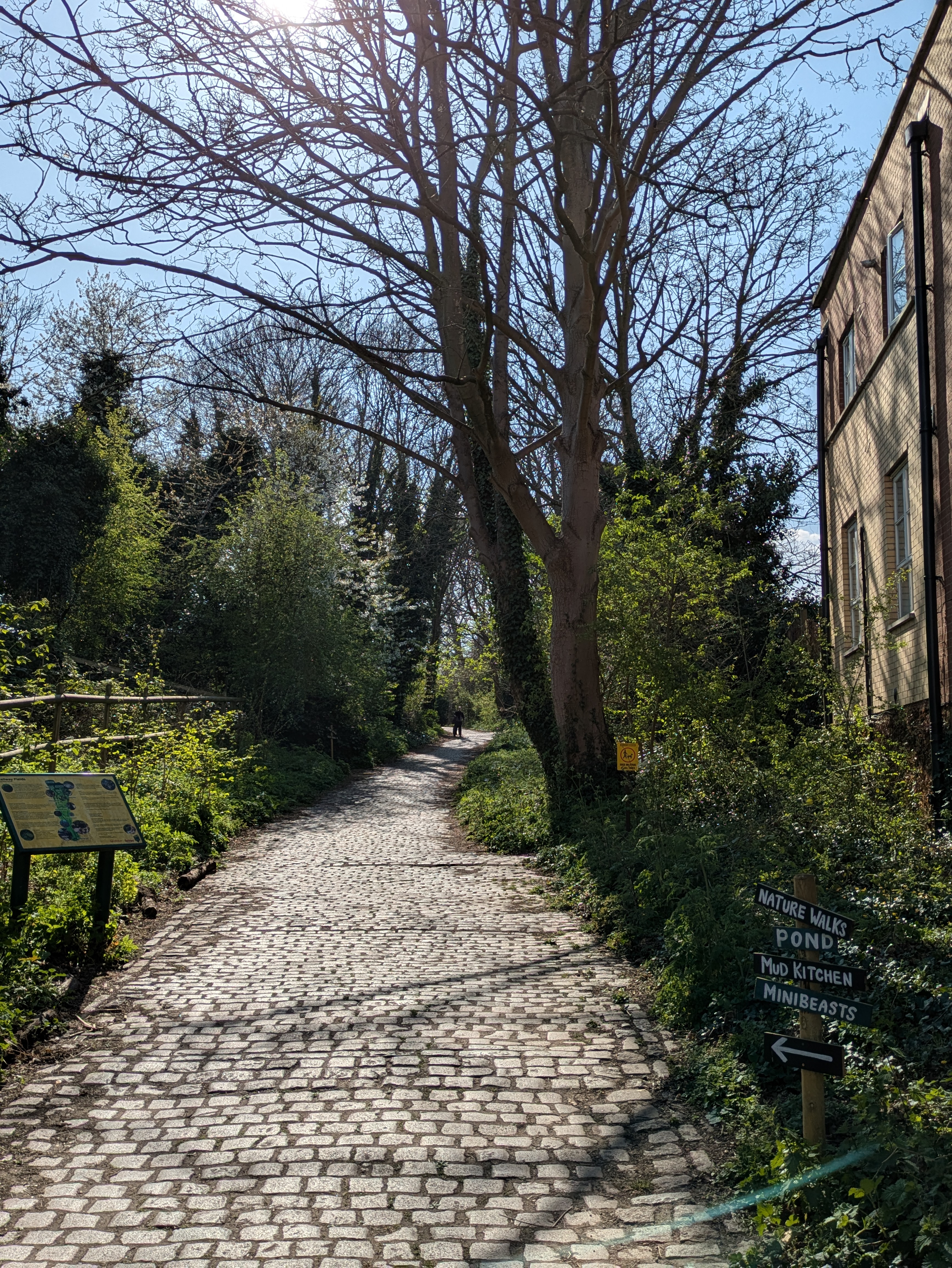
The most recognisable, to me, of those bird songs is the squeaking broken bicycle pump call of the Great Tit. Beyond that, quiet. Railway Fields is a small site, with just a couple of paths weaving through its two acres, but is home to myriad flora and fauna, and is especially important to insects, who make use of the oak, yew and poplar canopy and undergrowth. One tree looks quite unfamiliar with large, waxy leaves of a dark green, almost that of cavolo nero.
At one point the peace is disturbed by an animalian commotion in a bush right by where I’m standing, making me jump (“If there’s a bustle in your hedgerow, don’t be alarmed now, it’s just a spring clean for the May Queen”).
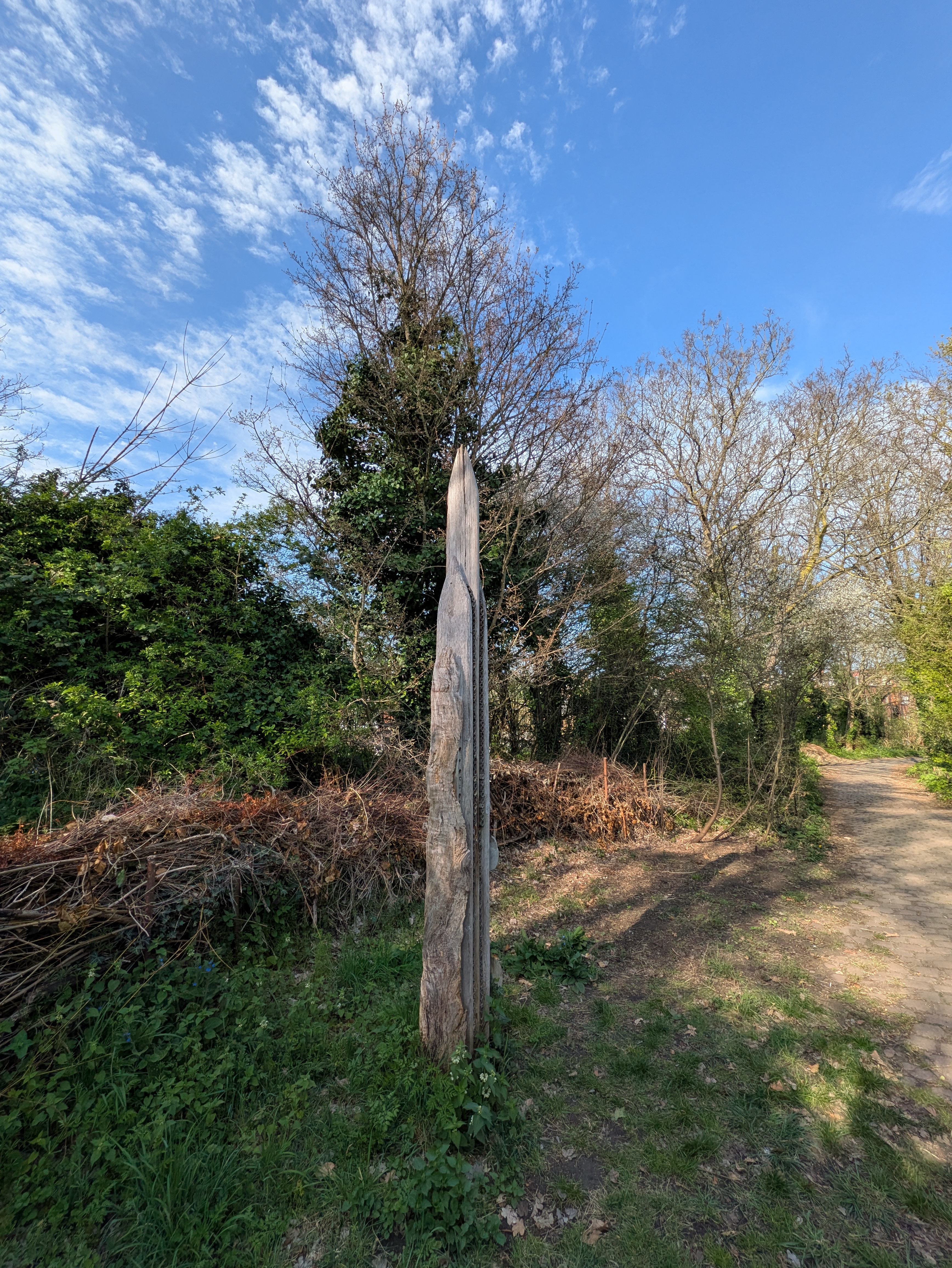
The main path through Railway Fields is crossed by an old railway track. Other hidden landmarks giving clues to the site’s previous life as railway coal yard include a 10m high crimson brick chimney and a rusting iron ’30’ sign, presumably instructing engine drivers of the speed limit.
One unusual structure that I encounter looks at first like a collection of ancient Norse monoliths stacked against each other, but transpires to be a 3m high ‘bug skyscraper’. Instead of runes, it is decorated with small tubes in which creepy crawlies can set up home.
The site is hemmed in on each side – the houses of the Ladder to the north, the aforementioned Green Lanes to the east, the New River to the west, and the railway line, recently renamed the Suffragette Line, to the south. Once the Silverlink, this Overground line is named in honour of the members of the Suffragette movement who resided in and began campaigning in Barking, where one end terminates (the other end meeting the Mildmay line at Gospel Oak).
As for the New River, the clue is in the name: it is not a river, but a man-made water channel constructed in the 17th century to bring a fresh water supply from the Lee Valley in Hertfordshire to Clerkenwell. From there, water was connected to the homes and businesses of those who could afford to pay for the luxury via wooden pipes…probably a more efficient service than that provided by Thames Water today. The New River still serves Londoners, with around 8% of the city’s water being delivered by this Jacobean aqueduct.
After a couple of loops of the upper and lower paths (“yes, there are two paths you can go by, but in the long run, there’s still time to change the road you’re on”), I fall into step with a group of Irish mums and their toddlers, who are debating who can go the longest without needing the toilet. Their gorgeous sing-song accents make me think of one the older diasporas to make north London their home – the Irish population often centred slightly further west around Holloway – but, turning left (north) onto Green Lanes, it is Turkish that is virtually the lingua franca, rivalling Multicultural London English.
Where my walk has so far been one of blue sky, red brick, and green trees, another colour grows in prominence – gold. This section of Green Lanes is home to at least a half dozen shops peddling the stuff, often so gaudy and studded with diamonds. Precious metal aside, gold is also the colour of the pastry that takes pride of place in the windows of the countless Turkish bakeries here – in the baklava, the börek and the gözleme.
Readers of my recent blogs on Istanbul (not Constantinople!) will recall my metaphor of the city as compass or ‘geohistorical sextant’. Placing a compass on this corner of N4 would allow one to chart out Jewish and West African communities to the north-east and east, Greek and Cypriot to the north, metropolitan middle-class to the west, and hipster to the south. However, the place name I notice repeated along this stretch of Green Lanes is not Istanbul but Gaziantep, or ‘Antep’ colloquially, the southern Turkish city that was devastated by earthquake in 2023. The city’s name pops up in the monikers of several cafes, restaurants and stores, hinting at a large portion of the community maintaining links there.
Making a pit stop in one such named cafe, I park myself at a table on the small front patio so that I can watch the stream of people flow by. A mum and two teenage daughters take the table next to me, chatting away in Turkish. Taking a call on her mobile, the mum is clearly giving directions. Not a minute later, a delivery rider beeps his horn, pulls up in front, and hops off his moped. Skipping over, he exchanges kisses with all three, and acknowledges me with a grin and a wink as he pinches a piece of baklava from one of his daughters – cue melodramatic gasps at such chutzpah and a playful whack to his helmeted head.
I’ve known this area for around 25 years, almost half the lifetime of the London Borough of Haringey, which was founded in 1965 after the London Government Act. Note the slight change in spelling – Haringey, Harringay and my home area of Hornsey all derive from Hæringeshege, which conflicting accounts say either meant ‘hare’s meadow’ or ‘Hæring’s enclosure’, after a local Saxon chief.
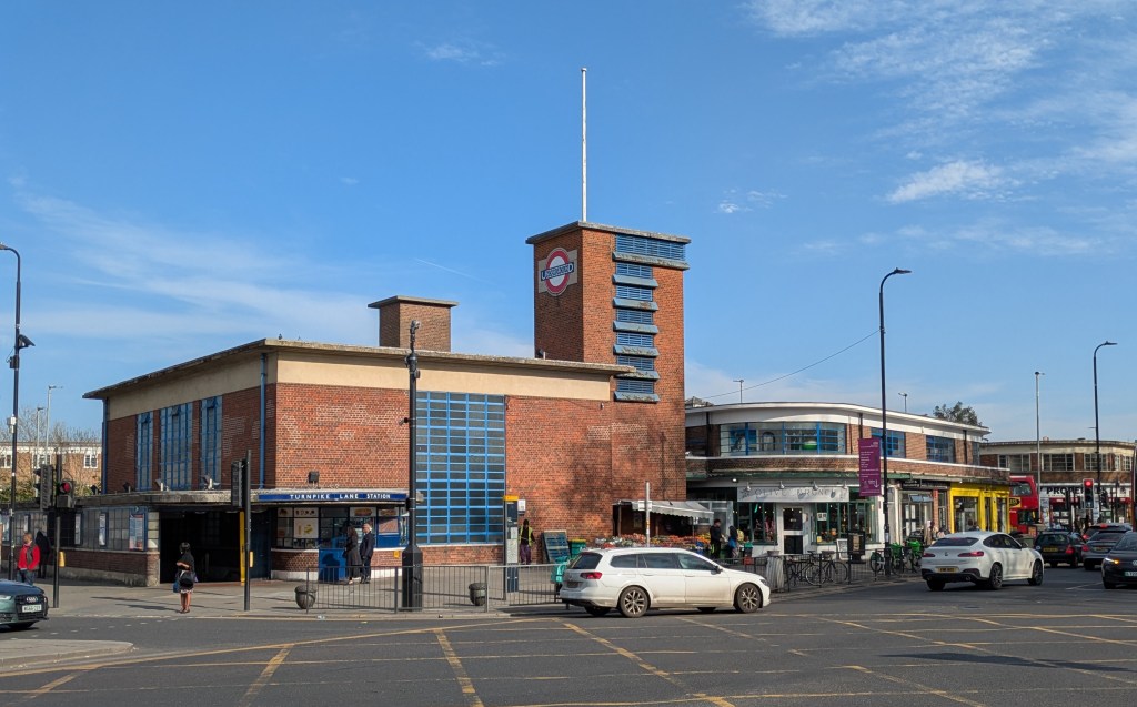
Green Lanes becomes less interesting the further north it gets, echoed by the rather dull Duckett’s Common at the Turnpike Lane junction. Similarly, the tube station is far from the most interesting, despite being designed by the master of modernism, Charles Holden. To see some of his more impressive work, hop on the Piccadilly northbound to Arnos Grove, Cockfosters, or – my personal favourite – the UFO-like ‘streamline moderne’ design at Southgate.
Tramping back due-east, the sun is starting to lower, causing me to squint. As we know, being part-blinded won’t mean I miss much along this grimy stretch of Turnpike Lane. Passing back into the stark light from the darkness below Hornsey railway bridge, a smile instinctively sparks across my face upon spotting a new mural that has gone up, brightening this drab wall – beaming back at me, thumb raised, is a black and white image of ‘Star Boy’, role-model and happy genius, Bukayo Saka. This work of art isn’t signed, but I symbolically doff my cap to both the artist and Arsenal’s mercurial #7.
I reach my final destination – the churchyard of St Mary’s, Hornsey. Although the outline of the nave can clearly be made out, now forming the perimeter of the garden, the church tower is all that remains of a structure dating back some five centuries. On its annual open days, the view from the rooftop is worth the climb up the treacherous stairway, gazing north to Ally Pally, with its own spire cresting the hill, and sliding southwards, descending the rungs of the Ladder.
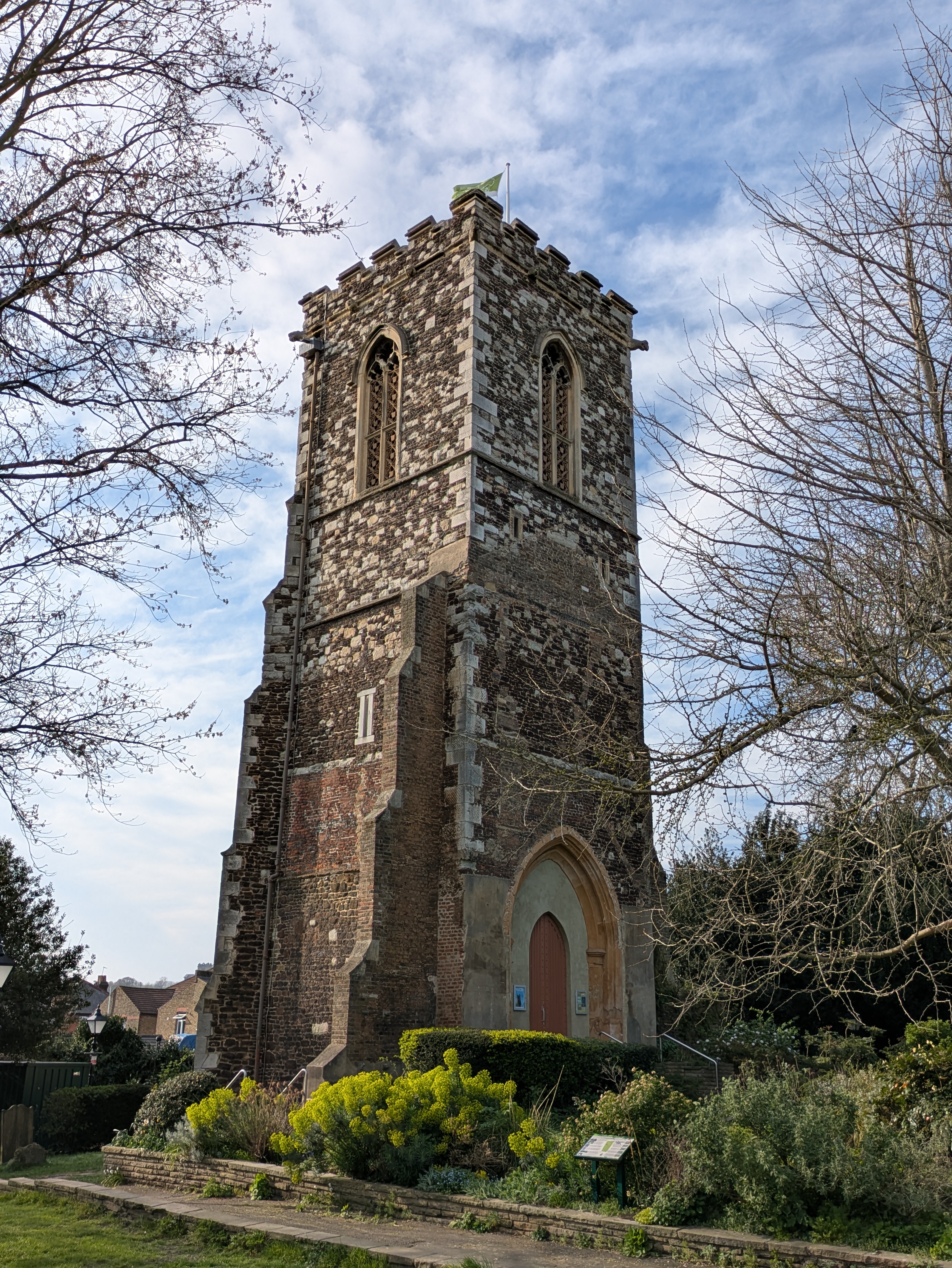
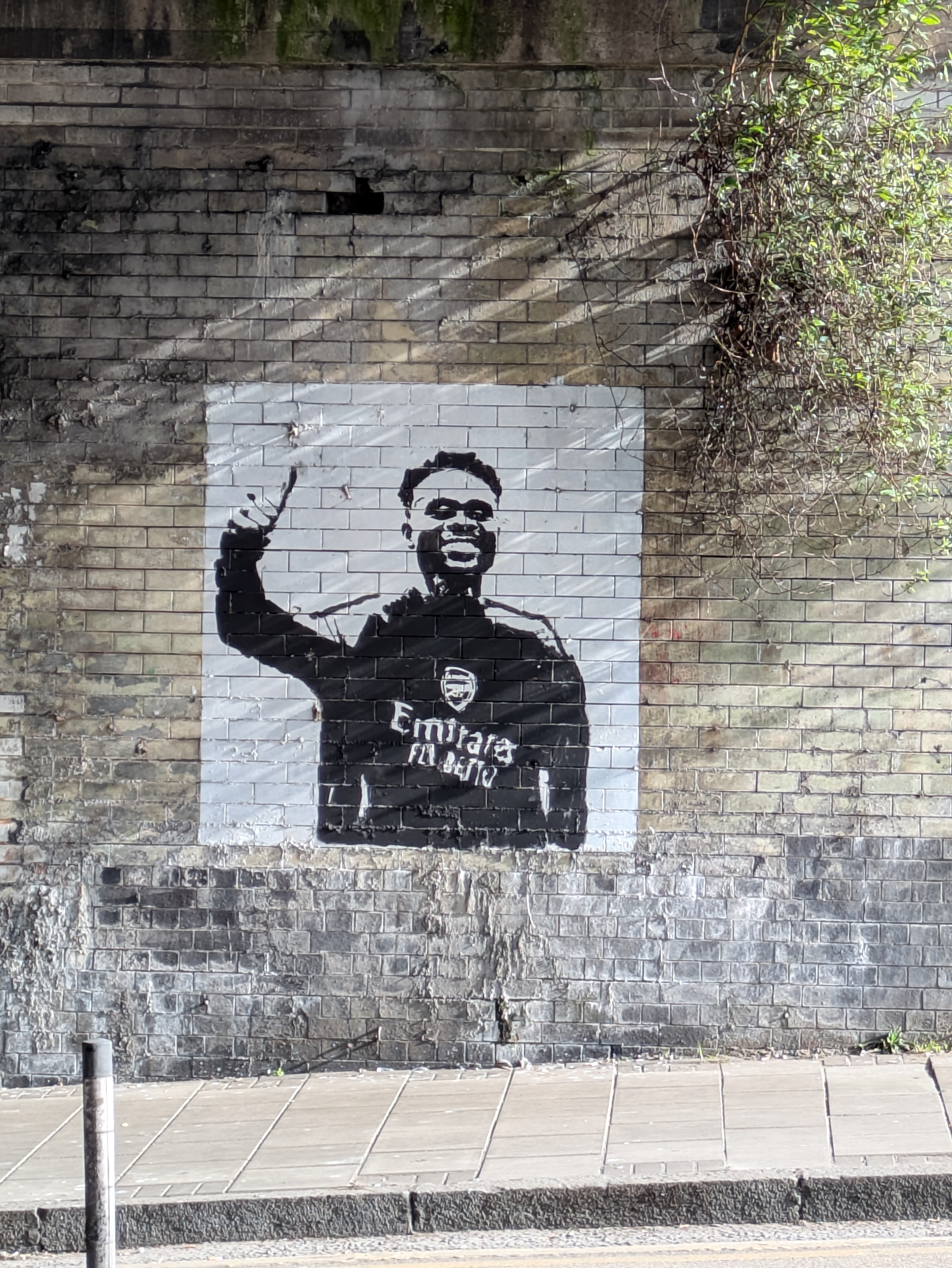
Above: St Mary’s, Hornsey; a mural to a latter day saint, Bukayo Saka, under Hornsey railway bridge (artist unknown).
The song lyrics quoted in the Railway Fields section are from Led Zep’s ‘Stairway to Heaven’ (Page & Plant).
Further reading:
https://hornseyhistorical.org.uk/brief-history-harringay/
https://hornseyhistorical.org.uk/how-did-the-harringay-ladder-roads-get-their-names/
https://www.ianvisits.co.uk/articles/londons-alleys-harringay-passage-n4-24888

Leave a comment